RV Camping in Sequoia National Forest: Campgrounds, Kern River & Free Dispersed Sites
The National Forest, not the National Park — where to RV camp around Hume Lake, the Western Divide, and the Kern River, plus the free dispersed camping the park can't offer.
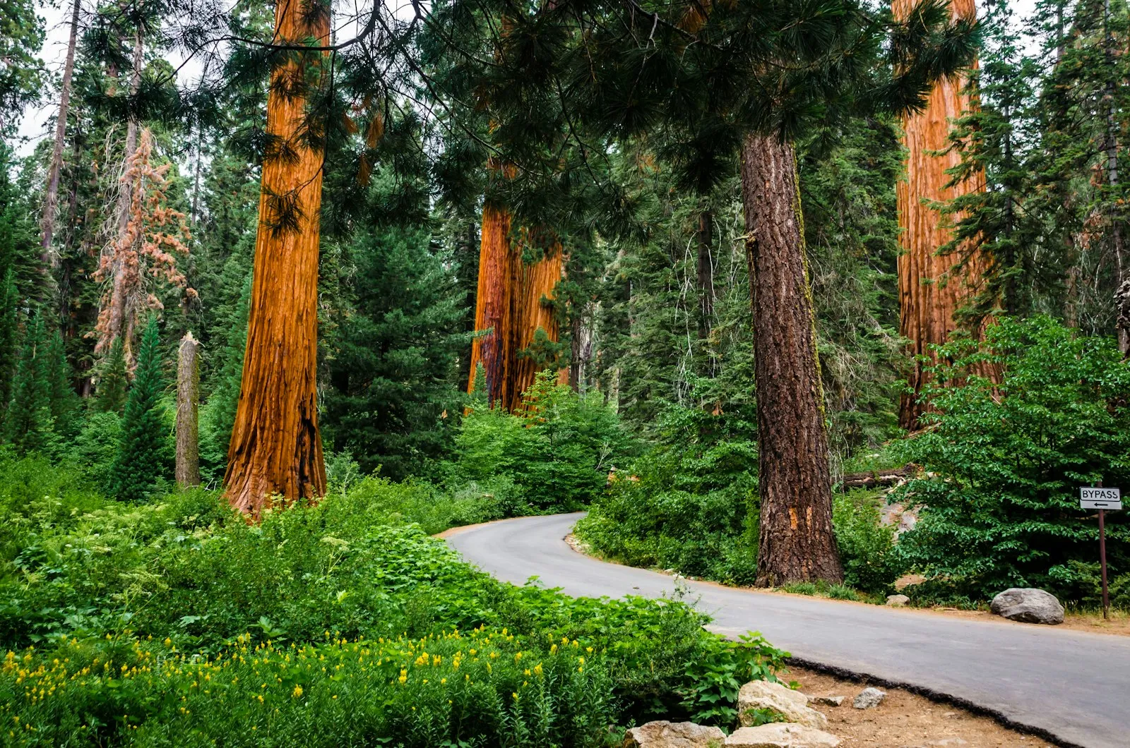
Here’s a distinction that saves RVers money, headaches, and at least one argument with a ranger: Sequoia National Forest is not Sequoia National Park. The park is the famous one — General Sherman, the Giant Forest, the $35 entrance gate. The forest is the 1.1-million-acre expanse of Forest Service land wrapped around it to the south and west, and for anyone traveling with an RV, it’s honestly the better place to sleep.
The case is simple. The forest charges no entrance fee. Dogs are allowed on forest trails — they’re banned from nearly every trail in the park. Campsites run $32–36 a night instead of park rates plus the gate fee. Big rigs have real options here, while the park’s Generals Highway prohibits vehicles over 22 feet on its most famous stretch. And the forest offers something the park never will: free dispersed camping, legal across most of its acreage. You can park your rig in a pine clearing at 7,000 feet, pay nothing, and wake up a short drive from sequoia groves — the forest contains Giant Sequoia National Monument, which protects dozens of groves of the same giant trees the park is famous for.
If your trip is actually about the National Park itself — General Sherman, Moro Rock, Kings Canyon — start with our Sequoia & Kings Canyon RV camping guide instead. This guide covers the forest: the Hume Lake area up north, the Western Divide Highway in the middle, the Kern River corridor down south, and the dispersed camping that ties it all together.
Hume Lake & the Kings Canyon Corridor
The northern chunk of the forest sits along Highway 180 between Grant Grove and Kings Canyon, in the Hume Lake Ranger District. This is the area to base in if you want to visit the national parks without paying park campground scarcity prices — you’re 20–30 minutes from Grant Grove and the General Grant Tree.
Hume Lake Campground
An 87-acre reservoir at roughly 5,200 feet, ringed by pines, with a campground close enough that many sites are a short walk from the water. Hume Lake is the most developed camping in the forest — there’s a Christian camp on the far shore whose public-facing concessions mean you can walk to groceries, gasoline, and boat rentals within a half mile of most campsites. That’s a luxury nothing else in this guide offers. The lake itself is the draw: swimming, fishing, kayaking, and a flat 2.5-mile trail around the shoreline that’s genuinely pleasant with a dog.
- Hookups: None
- Sites: 74 (tents, trailers, RVs)
- Cost: $36/night single, $71 double
- Season: Mid-May to mid-September
- Reservation: Recreation.gov — book early, this one fills fast
- Max RV length: Parking spurs run 15 to 42 feet; sites across the loops handle RVs up to about 40 feet
- Amenities: Potable water, flush toilets, trash collection, lake access, nearby store and gas
Princess Campground
Three miles northwest of Hume Lake at 5,900 feet, right off Highway 180, Princess sits at the edge of a big meadow in Indian Basin — a logged-over sequoia grove where enormous century-old stumps stand among young sequoias growing back around them. It’s a strangely moving place to camp, equal parts monument and scar. Practically, Princess is the best big-rig campground in the entire forest: it’s the largest, the most RV-friendly, and it has the area’s dump station.
- Hookups: None, but dump station on site ($20)
- Sites: 88 total — 63 handle RVs and trailers, 19 tent-only
- Cost: $36/night single, $71 double, $8 extra vehicle
- Season: Late May to late September
- Reservation: Recreation.gov, with some first-come, first-served sites
- Max RV length: RV sites accommodate rigs from 20 up to 50 feet
- Amenities: Vault toilets, potable water, picnic tables, fire rings, dump station
Stony Creek Campground
South of the Hume Lake area on the Generals Highway, Stony Creek sits at about 6,400 feet in the strip of national forest sandwiched between Sequoia and Kings Canyon National Parks. That location is the whole pitch: you’re camped on cheaper Forest Service land roughly halfway between Grant Grove and the Giant Forest, with a small seasonal lodge and store next door. Sites sit among big conifers along the creek. The catch is size — this is a mid-size-rig campground, not a big-rig one, and reaching it means driving park roads (see the road warnings below).
- Hookups: None
- Sites: 42, including 17 tent-only
- Cost: $32–64/night depending on site type
- Season: Late May to late September
- Reservation: Recreation.gov
- Max RV length: 25 sites handle RVs and trailers of 20–30 feet; leave the 40-footer elsewhere
- Amenities: Vault toilets, drinking water, picnic tables, fire rings, amphitheater, adjacent lodge/store
The Western Divide Highway
The middle of the forest is reached from the west via Highway 190 out of Springville — a climb from 1,000 feet to 7,000 feet in about 25 winding miles. At the top, the Western Divide Highway runs south along the crest through Giant Sequoia National Monument. This is the forest at its best and least crowded: sequoia groves without the park’s tour buses, and the Trail of 100 Giants, a paved, wheelchair-accessible loop through the Long Meadow Grove that stands comparison with anything inside the park ($12/vehicle day-use fee at the trailhead lot).
Quaking Aspen Campground
At 7,000 feet, a quarter mile past where Highway 190 ends and the Western Divide Highway begins — 27 miles east of Springville. Meadow on one side, aspens and conifers on the other, cool nights all summer. It’s the natural base for the Needles (the famous granite spires above the Kern Canyon) and for exploring the monument’s groves. Note the length limit: turnaround space inside the loops is tight, and the Forest Service explicitly restricts RVs over 26 feet.
- Hookups: None
- Sites: 30 standard sites, 4 tent-only, plus 2 cabins and 3 group sites
- Cost: From $32/night; group sites $62–242
- Season: Roughly May 30 to October 31, weather depending — one of the longer high-country seasons
- Reservation: Recreation.gov
- Max RV length: 26 feet — enforced by geometry, not just signage
- Amenities: Potable water, vault toilets, tables, fire rings/BBQ stoves
Redwood Meadow Campground
A few miles further south on the Western Divide Highway, directly across from the Trail of 100 Giants — you can walk from your site to the sequoias. It’s tiny: a handful of standard sites plus a cluster of rentable yurts, which makes it more a lucky score than a plan. Published RV guidance is stingy (sources list limits between 16 and 24 feet), so treat this as a small-rig and camper-van spot only. If it’s full, Quaking Aspen is 15 minutes back up the road, and dispersed pullouts line the forest roads nearby.
- Hookups: None
- Sites: 6–8 standard sites plus 6 yurts
- Cost: From $36/night (yurts more)
- Season: Summer only, typically late May through September
- Reservation: Recreation.gov
- Max RV length: Small rigs only — under about 24 feet, and shorter is safer
- Amenities: Vault toilets, tables, fire rings; walkable access to the Trail of 100 Giants
The Kern River Corridor
The southern end of the forest is a different world. The Upper Kern River runs through a granite canyon north of Kernville at around 2,700 feet — hot in summer, snow-free most of the year, and lined with a string of Forest Service campgrounds along Mountain Highway 99 (the Kernville–Johnsondale road). This is where Southern California comes to raft, fish, and cool off; Kernville itself is a genuine little river town with outfitters, restaurants, and real grocery stores.
First, the warning, because it isn’t decoration: the Kern is one of the deadliest rivers in America. The sign at the mouth of the canyon keeps a running tally — it recorded 317 lives lost between 1968 and 2021, and the count has since climbed past 325. The Kern is snowmelt moving fast through boulders; the Forest Service warns that falling in is as dangerous as swimming, and most victims are out-of-town visitors who underestimated it. Camp beside it, fish its edges, raft it with a licensed outfitter — but in spring and early summer high water, stay out of the current, and never let kids or dogs near the bank unsupervised. The campgrounds below are wonderful. The river demands respect.
Headquarters Campground
The first of the Upper Kern campgrounds, 6 miles north of Kernville, with sites strung along the river close enough to fall asleep to it. It’s a mix of standard, RV, and tent-only sites, and its low elevation means it opens earlier and closes later than anything in the high country — locals use it for shoulder-season trips when Hume Lake is still under snow.
- Hookups: None
- Sites: Mixed standard, RV, and tent-only sites along the river
- Cost: $36/night single, $8 extra vehicle
- Season: Long season at low elevation; core season spring through fall
- Reservation: Some sites on Recreation.gov, some first-come, first-served
- Max RV length: 27 feet
- Amenities: Vault toilets, drinking water, fire rings, riverside sites
Hospital Flat Campground
Half a mile up the road from Headquarters — 6.5 miles north of Kernville — on a flat river bench that reportedly served as a camp infirmary in the area’s logging days, hence the name. Slightly bigger sites and a grassy, open feel compared to its neighbor.
- Hookups: None
- Sites: 40 family sites plus 1 accessible group site
- Cost: $34/night single, $8 extra vehicle; group site $152
- Season: Roughly May through September
- Reservation: Recreation.gov
- Max RV length: 30 feet
- Amenities: Vault toilets, water, fire rings, accessible group unit with ramp
Camp Three Campground
The workhorse of the Upper Kern: 52 paved sites and a group camp, about 5 miles north of Kernville. Paved pads make it the easiest leveling job on the river, and the size means it’s often the last to fill on a summer weekend. Rafting outfitters use the nearby river access points, so expect cheerful commotion in June and July.
- Hookups: None
- Sites: 52 paved sites plus a 30-person group site
- Cost: $34/night; group site $145; $8 extra vehicle
- Season: Roughly late May to mid-September
- Reservation: Recreation.gov
- Max RV length: 30 feet
- Amenities: Paved pads, drinking water, vault toilets, fire rings, river access
Free Dispersed Camping: The Forest’s Best Deal
This is the section that separates the forest from the park. Dispersed camping — camping outside developed campgrounds — is free and legal across most of Sequoia National Forest. No reservation, no nightly fee, no entrance gate. For self-contained rigs, it’s some of the best free camping in California outside the desert.
The rules, straight from Forest Service guidance:
- Camp at least 200 feet from any lake, stream, or river. Water sources are fragile, and this rule is the one rangers actually enforce.
- Stay a quarter mile from developed campgrounds and trailheads. You can’t boondock in the Hume Lake overflow lot.
- 14-day stay limit, forest-wide. Moving five miles down the road doesn’t reset the clock — the limit applies to the whole forest.
- Use existing sites. Pull into clearings and spurs that already show use rather than driving over vegetation to make new ones.
- Pack out everything, including gray water and human waste where there’s no toilet. The forest’s dispersed areas stay open because people leave them clean.
The fire permit is not optional. California requires a free campfire permit from CAL FIRE for any open flame outside a developed campground — and that includes your propane stove and gas grill, not just wood fires. It takes five minutes online (you watch a short video and print or save the permit). Then check current fire restrictions before every trip: by mid-summer in most years, seasonal restrictions ban wood fires entirely in dispersed areas, and in bad years they ban stoves too. The ranger district offices in Kernville and Springville have the current word.
Where to look: forest roads off the Western Divide Highway hide meadow-edge clearings at 6,000–7,000 feet that rival any paid site in the state; the Rancheria Road/forest road network around Greenhorn Summit west of the Kern serves Kernville-area boondockers; and the roads branching off Highway 190 above Springville have well-used pullouts. Scout ahead on foot before committing a big rig down any forest road — these are unpaved, unmarked, and turnaround opportunities are not guaranteed. If dispersed camping is new to you, our beginner’s boondocking guide covers the self-sufficiency basics, and the California boondocking guide and BLM camping guide cover the wider free-camping landscape across the state.
Every Campground at a Glance
| Campground | Area | Sites | Cost/night | Max RV | Season | Water |
|---|---|---|---|---|---|---|
| Hume Lake | Hume Lake / Hwy 180 | 74 | $36 | ~40 ft (spurs to 42 ft) | Mid-May–mid-Sept | Yes, flush toilets |
| Princess | Hume Lake / Hwy 180 | 88 | $36 | Up to 50 ft | Late May–late Sept | Yes + dump station ($20) |
| Stony Creek | Generals Hwy | 42 | $32–64 | 30 ft | Late May–late Sept | Yes |
| Quaking Aspen | Western Divide Hwy | 30 + group | From $32 | 26 ft | ~May 30–Oct 31 | Yes |
| Redwood Meadow | Western Divide Hwy | 6–8 + yurts | From $36 | ~24 ft, small rigs | Summer | Limited |
| Headquarters | Kern River | Mixed | $36 | 27 ft | Long season | Yes |
| Hospital Flat | Kern River | 40 + group | $34 | 30 ft | ~May–Sept | Yes |
| Camp Three | Kern River | 52 + group | $34 | 30 ft | Late May–mid-Sept | Yes |
| Dispersed | Forest-wide | — | Free | Road-dependent | Varies by elevation | No |
All fees are per night for a single site and were current as of mid-2026; confirm on Recreation.gov when you book.
Planning Your Trip
Season and snow. The forest spans 1,000 to over 12,000 feet, so “when to go” depends entirely on which zone you’re camping in. The Hume Lake and Western Divide campgrounds sit between 5,200 and 7,000 feet — they open in late May, close by late September or October, and their access roads close under snow in winter. The Kern River corridor, down around 2,700 feet, is the year-round-ish option: mild in spring and fall, hot (regularly over 95°F) in July and August. A smart summer itinerary uses both — river mornings in June before the high country opens, mountain camps in August when Kernville bakes.
Roads: know which mountain you’re climbing. Three main approaches, three very different drives. Highway 180 from Fresno to the Hume Lake area is the easy one — a real highway, fine for any rig, and it reaches Princess and Hume Lake without touching the national park’s restricted roads. Highway 190 from Springville to the Western Divide climbs about 6,000 feet in 25 miles of tight switchbacks; it’s paved and doable in a mid-size rig driven patiently, but it’s slow, and anything over 30 feet will hate it (and won’t fit at the top anyway — remember Quaking Aspen’s 26-foot limit). Mountain 99 north from Kernville along the river is the gentlest, following the canyon to the Upper Kern campgrounds. What you should not do is treat the Generals Highway as a through-route with a big rig: the section between the park’s Foothills entrance and the Giant Forest prohibits vehicles over 22 feet. If you’re camping at Stony Creek with a trailer, come in from the north via Highway 180, not up from Three Rivers.
Cell signal: assume none. Kernville and Springville have normal coverage; the moment you climb into the forest, expect nothing. Hume Lake gets spotty service thanks to the camp’s infrastructure, but the Western Divide and the Upper Kern canyon are dead zones. Download offline maps, tell someone your plan, and treat this as a feature — it mostly is.
Supplies. Kernville is the best resupply in the region: groceries, fuel, propane, outfitters, and restaurants, all within minutes of the Kern campgrounds. Springville has basics at the bottom of the 190 climb — top off fuel here, because there’s none on the Western Divide. In the north, the small store and gas pumps at Hume Lake handle essentials, but do real shopping in Fresno or Squaw Valley on the way up Highway 180. Nothing in the forest has hookups, so arrive with water full, tanks empty, and a plan for power — Princess’s $20 dump station is the most useful sanitation stop north of Kernville.
Fitting it into a bigger trip. The forest pairs naturally with the parks it surrounds — camp at Princess and day-trip into Kings Canyon, or use Stony Creek as the midpoint of a parks tour. If you’re stitching together a longer California route, our best RV parks in California guide covers the full-hookup stops between the public lands.
The Bottom Line
Sequoia National Forest is what public-lands camping looked like before reservation systems turned every summer weekend into a lottery: $34 riverside sites, 50-foot pads under sequoia stumps, and a million acres where a self-contained rig can still camp for free. The park next door gets the fame. The forest gets you a campsite — cheaper, with the dog on the trail, and often within sight of the same giant trees. Book Princess or Hume Lake for the northern groves, take the small rig up the Western Divide, respect the Kern absolutely, and keep a CAL FIRE permit in the glovebox. That’s the whole formula.
Frequently asked questions
What's the difference between Sequoia National Forest and Sequoia National Park?
They're separate federal lands under different agencies. Sequoia National Park is run by the National Park Service — entrance fee required, dogs banned from trails, no dispersed camping. Sequoia National Forest is run by the U.S. Forest Service and wraps around the park to the south and west — no entrance fee, dogs allowed on trails, and free dispersed camping is legal across most of the forest. The forest also contains Giant Sequoia National Monument, which protects dozens of sequoia groves outside the park.
Is dispersed camping free in Sequoia National Forest?
Yes. Dispersed camping is free and legal across most of Sequoia National Forest with no reservation required. The main rules: camp at least 200 feet from water, stay a quarter mile from developed campgrounds and trailheads, use existing pullouts and clearings rather than creating new ones, and respect the 14-day stay limit, which applies forest-wide even if you move to a different spot.
Do I need a fire permit to camp in Sequoia National Forest?
For dispersed camping, yes. California requires a free campfire permit — issued by CAL FIRE and available online — for any open flame outside a developed campground, and that includes propane stoves and gas grills, not just wood fires. Inside developed campgrounds with metal fire rings, the campground rules apply instead. Seasonal fire restrictions frequently ban all open fires in dispersed areas by mid-summer, so check current restrictions with the ranger district before you light anything.
Can big rigs camp in Sequoia National Forest?
Yes, but choose your campground carefully. Hume Lake Campground has parking spurs up to 42 feet, and Princess Campground has sites handling RVs and trailers from 20 to 50 feet — those are your best big-rig options. On the Kern River, campgrounds top out around 27 to 30 feet, and Quaking Aspen on the Western Divide Highway limits RVs to 26 feet because of tight turnarounds. Nothing in the forest has hookups, so arrive with full water and empty tanks.
When is the best time to RV camp in Sequoia National Forest?
June through September for the high country. Most campgrounds at Hume Lake, Stony Creek, and the Western Divide open in late May and close by late September or October — they sit between 5,200 and 7,000 feet, and snow closes the access roads in winter. The Kern River corridor near Kernville sits much lower (around 2,700 feet), runs hot in summer, and has some camping available nearly year-round.
Are there hookups at any Sequoia National Forest campground?
No. Every developed campground in the forest is dry camping — no electric, water, or sewer hookups at individual sites. Princess Campground has a dump station ($20 fee), which is the most useful sanitation stop in the Hume Lake area. If you need full hookups, private parks in Kernville and Three Rivers are your fallback.
About the author
Marisol ReyesCamping & Outdoors Editor
Marisol spent six years as an interpretive ranger in the California and Colorado state park systems before turning to writing full-time. She knows public-land camping from the inside — how reservation windows really work, why some loops fill before others, and which 'first-come, first-served' sites are worth gambling on.
More from Marisol →Keep reading
Oceanfront RV Parks in California: Where You Can Park With a Pacific View
Seven verified California oceanfront RV parks with 2026 rates, hookup types, and rig-length limits — from Morro Strand and Pismo to Jalama, Carpinteria, San Elijo, and Doheny.
RV Camping in Yosemite National Park: The In-Park Campground Guide
RV parks near Yosemite are great — but if you want to sleep inside the park, here's the honest guide to every Yosemite campground that takes RVs.
Palm Springs RV Parks and Resorts: 6 Desert Parks Compared (Hot Tubs, Pools, Hot Springs)
Compare six verified Palm Springs RV resorts and RV parks by hookups, pools, hot tubs, mineral hot springs, fitness facilities, rig fit, age rules and fees — including the Desert Hot Springs mineral-pool resorts.