The Best Free Camping Apps for Finding Boondocking Sites
The free camping apps that actually work in 2026 — Campendium, FreeRoam, iOverlander, The Dyrt, Recreation.gov, and onX Offroad — and exactly what each is good for.
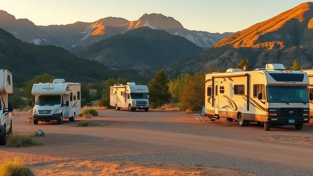
Finding free camping used to mean a worn paper atlas, a CB radio, and local knowledge. Today it means an app — or, more honestly, a handful of apps, because no single one does everything well. The right toolkit turns “where can I legally sleep tonight?” from a stressful gamble into a two-minute lookup, complete with photos, road-condition notes, and whether you’ll have a cell signal when you get there.
The trouble is that the camping-app landscape is cluttered with options, some abandoned, some paywalled into uselessness, and some genuinely excellent. We’ve sorted through the field and focused only on tools that are real, currently operating, and pulling their weight in 2026. We’ll tell you what each one is actually good at, what it costs, and how to combine them — because the experienced boondocker’s secret is that these apps are complementary, not competitors.
This is the tooling companion to our free RV camping and boondocking guide and our BLM camping guide. Those cover where you can camp and the rules; this covers how you find the specific spot.
Campendium — the all-around boondocking standard
If you download only one app, make it Campendium. It’s a large crowd-sourced database of campsites — free dispersed, BLM, national forest, developed, and private — with the kind of detailed, honest reviews that boondockers actually need.
What sets it apart:
- Free-site coverage. It’s built with boondockers in mind, so free dispersed and BLM sites are well represented, not buried under paid resorts.
- Cell-signal reports. Reviewers log which carrier worked and how strong the signal was at each site — invaluable if you work on the road or just want to know whether you’ll have a connection.
- Honest reviews and photos. Real users describe road conditions, rig-size suitability, noise, and whether a site was accessible recently.
Campendium is owned by Roadtrippers. The base app is free; Campendium Pro runs about $20/year and adds features like offline maps and additional filters.
Field tip: Sort Campendium reviews by most recent before trusting a site. A spot that was a quiet five-star desert pullout two years ago may now be gated, crowded, or washed out — recent reviews catch what old ones miss.
Best for: your default first lookup for free and cheap sites, especially when cell signal matters.
FreeRoam — the best truly-free option
FreeRoam earns a permanent place on the home screen for one reason: it’s completely free, with no premium tier, no paywall, and no ads. For a boondocking app, that’s increasingly rare and genuinely valuable.
Beyond price, FreeRoam’s strength is its public-land map layers. It overlays BLM, national forest, and other land ownership directly on the map, alongside user-reported campsites, so you can scout dispersed-camping country and find specific sites in one view. It also surfaces practical filters boondockers care about — cell coverage, elevation, road conditions, and weather.
The community is smaller than Campendium’s or The Dyrt’s, so coverage in any given area can be thinner. But for free public-land scouting, it’s one of the most capable tools available, and there’s no reason not to have it.
Best for: scouting public land, confirming land type, and budget-conscious RVers who want a no-cost, no-nonsense app.
iOverlander — for the backroads and beyond
iOverlander grew out of the overlanding community — people driving remote routes across continents — and it shows. Its database leans toward the off-the-beaten-path: backcountry pullouts, informal sites, and the kind of spots you reach down a rough dirt road rather than off an interstate exit.
It’s free on both the app and the web (ioverlander.com gives full world-map access with no account and no subscription), and it catalogs more than just campsites — water fill points, dump stations, mechanics, and other traveler resources are all logged. If you’re heading somewhere genuinely remote, or you want to know where the next potable-water tap is, iOverlander often has data the mainstream apps miss.
The trade-off is that its sites skew rugged and its US developed-campground coverage is weaker than the dedicated camping apps. It’s a complement, not a replacement.
Field tip: iOverlander is your best friend for the logistics of boondocking — finding free dump stations and water fills between sites. Cross-reference its water/dump points with your tank levels to plan how long you can stay out.
Best for: remote and backroad sites, overlanding, and finding water and dump stations off-grid.
The Dyrt — the biggest database
The Dyrt is the largest campground database of the bunch, covering everything from free dispersed sites to private RV resorts, packed with user ratings, reviews, and photos. If a campground exists, it’s probably in here.
The free version is useful for browsing and reviews. The Dyrt PRO (a paid subscription) adds the features road-trippers value most: offline maps, trip planning tools, a map layer for free public-land camping, and partner discounts on campground stays that can offset the membership cost.
Its breadth is the selling point — it’s strong on developed and private parks where boondocking-focused apps are thin. The flip side is that with so many listings, the free-dispersed signal can get diluted by paid parks, so it pairs well with a more boondocking-focused tool.
Best for: the widest selection of all camp types, trip planning, and stays where you want both free and developed options in one place.
Renting an RV for this trip? Compare rigs, prices, and pickup locations on RVshare and Outdoorsy — both let you filter by rig size, dates, and location.
Recreation.gov — the official federal booking app
Recreation.gov is a different animal: it’s not for finding free dispersed sites, it’s the official federal platform for reserving developed campgrounds. It covers 100,000-plus campsites across thousands of federal recreation areas, including the Army Corps of Engineers lakes, national forest campgrounds, national park campgrounds, and BLM developed sites.
For free-camping purposes, its value is the cheap-but-developed tier: Corps of Engineers campgrounds average around $20/night, often lakefront with hookups, and you book them here. When you want a hot shower, a dump station, and a guaranteed site to break up a stretch of boondocking — or when you’re east of the Rockies where free dispersed land is scarce — Recreation.gov is where you find it.
It also handles permits and timed-entry reservations for popular parks, so it earns a place on the phone regardless.
Best for: booking developed federal campgrounds (especially cheap Corps lakes), permits, and park reservations. Not for free dispersed sites.
onX Offroad — for verifying land ownership
onX Offroad isn’t a campsite-finder so much as a land-status map, and that makes it the most important safety tool in the kit. It color-codes land ownership — BLM, Forest Service, state, tribal, private — so you can confirm a spot is actually on public land where dispersed camping is legal before you camp there. It’s frequently described as the off-road app with BLM- and USFS-verified dispersed-camping data built into the map.
Where it shines:
- Boundary clarity. On a dirt road that crosses from BLM to private land with no signage, onX shows you exactly where the line is.
- Offline maps. Download the area before you lose signal — essential, since the best sites often have none.
- Trail and road data. Useful for judging whether a forest road suits your rig.
onX Offroad is a paid subscription, but for serious public-land campers it pays for itself the first time it keeps you from accidentally trespassing or driving a rig down a road it can’t handle.
Best for: confirming legal land status and navigating dispersed-camping country offline.
How to combine them: the boondocker’s toolkit
The reason no single app wins is that each solves a different part of the problem. Here’s how the pieces fit together in practice:
| App | Free version | Best at | Paid tier |
|---|---|---|---|
| Campendium | Yes | Free/cheap sites, cell-signal reports | Pro ~$20/yr |
| FreeRoam | Yes (fully free) | Public-land scouting, no-cost use | None |
| iOverlander | Yes (fully free) | Backroads, water & dump stations | None |
| The Dyrt | Yes | Largest all-type database, planning | PRO subscription |
| Recreation.gov | Yes (booking fees apply) | Developed federal campgrounds | N/A |
| onX Offroad | Trial only | Verifying land ownership offline | Subscription |
A realistic workflow for finding a free site tonight:
- Find candidates in Campendium and FreeRoam — read recent reviews for road conditions, rig fit, and cell signal.
- Verify the land status in onX Offroad (or the free BLM map) so you know the spot is legal public land.
- Plan the logistics with iOverlander — locate the nearest free water fill and dump station so you can plan your stay length.
- Keep a paid backup in Recreation.gov in case your dispersed spot is full, gated, or impassable.
- Download maps offline before you leave coverage, and screenshot the final directions.
Field tip: Battery and data are precious when boondocking. Do all your searching and map-downloading while you still have a signal and shore power — at a town stop or paid park before you head out — rather than burning your house batteries hunting for a site after dark.
A few honest caveats
No app is perfect, and trusting one blindly is how people end up stuck:
- Crowd-sourced data ages. A site can be closed, gated, or trashed since the last review. Recent reviews and a daylight arrival catch what the app can’t.
- Apps don’t override the law. A spot being listed doesn’t guarantee camping is currently legal there — closures and rule changes happen. Verify land status and look for posted restrictions yourself.
- Coverage varies wildly by region. All these apps are strongest in the West where free camping is abundant and thinnest in the East where it’s scarce. In the Southeast, lean harder on Recreation.gov for cheap Corps and forest campgrounds.
- Signal isn’t guaranteed. The best free sites are often where the apps can’t reach. Download offline maps and have your route planned before you go dark.
Get the toolkit set up and the rest of free camping gets dramatically easier. Pair these apps with the land knowledge in our free RV camping guide and the BLM specifics in our BLM camping guide, and if you’re just starting out, our boondocking tips for beginners ties it all together.
Frequently asked questions
What is the best free camping app?
There isn't one app that does everything well. Campendium is the best all-around app for finding free and cheap sites with detailed reviews and cell-signal reports. FreeRoam is the best fully-free option with strong public-land map layers. iOverlander is best for remote backroads and overlanding. Most experienced boondockers run two or three apps together rather than relying on a single one.
Are these camping apps actually free?
All of them have a free version that's genuinely useful. Campendium, The Dyrt, and onX Offroad also sell paid tiers that add offline maps, public-land overlays, or extra filters. FreeRoam and iOverlander are completely free with no paywall. Recreation.gov is free to use, though the campsites you book through it charge fees.
Which app finds free dispersed camping on public land?
FreeRoam and Campendium both surface user-reported free dispersed sites, while onX Offroad is the best tool for confirming a spot is actually on BLM or national forest land before you camp. iOverlander adds remote and backroad sites. Recreation.gov, by contrast, lists developed reservable campgrounds rather than free dispersed sites.
Do free camping apps work offline?
It varies. onX Offroad and The Dyrt's paid tiers let you download maps for offline use, which matters because many boondocking sites have no signal. FreeRoam and iOverlander cache some data but work best with a connection. Always screenshot directions and download maps before you leave cell coverage.
What's the difference between Campendium and The Dyrt?
Both are large crowd-sourced campground databases with reviews and photos. Campendium leans toward boondockers, with strong free-site coverage and cell-signal reports, and a low-cost Pro tier. The Dyrt has the larger overall database including private parks, and its paid tier (The Dyrt PRO) emphasizes trip planning, offline maps, and discounts. Many RVers use both.

About the author
Marisol ReyesCamping & Outdoors Editor
Marisol spent six years as an interpretive ranger in the California and Colorado state park systems before turning to writing full-time. She knows public-land camping from the inside — how reservation windows really work, why some loops fill before others, and which 'first-come, first-served' sites are worth gambling on.
More from Marisol →Keep reading
Central Texas RV Camping Guide: Seasons, Heat & Routing the Austin–San Antonio Loop
A planning guide to RV camping in Central Texas — best seasons, beating the summer heat, reservation strategy, and routing between Austin, San Antonio, and the Hill Country.
The Real Cost of Living in an RV Park Monthly (2026 Breakdown)
What a monthly RV-park stay actually costs in 2026 — honest lot-rent ranges by region, metered electric, propane, and the fees nobody quotes you up front.
National Park RV Rig-Size Limits: Tunnels, Roads & Campgrounds to Know
The rig-size limits that actually matter at major national parks — the Zion tunnel, Going-to-the-Sun Road, Old Fall River Road, and which campgrounds turn big rigs away.