Montana Boondocking: Legal Free Camping on Public Land
Plan legal Montana boondocking with current BLM and Forest Service stay limits, official maps, access checks, bear safety, and practical RV regions.

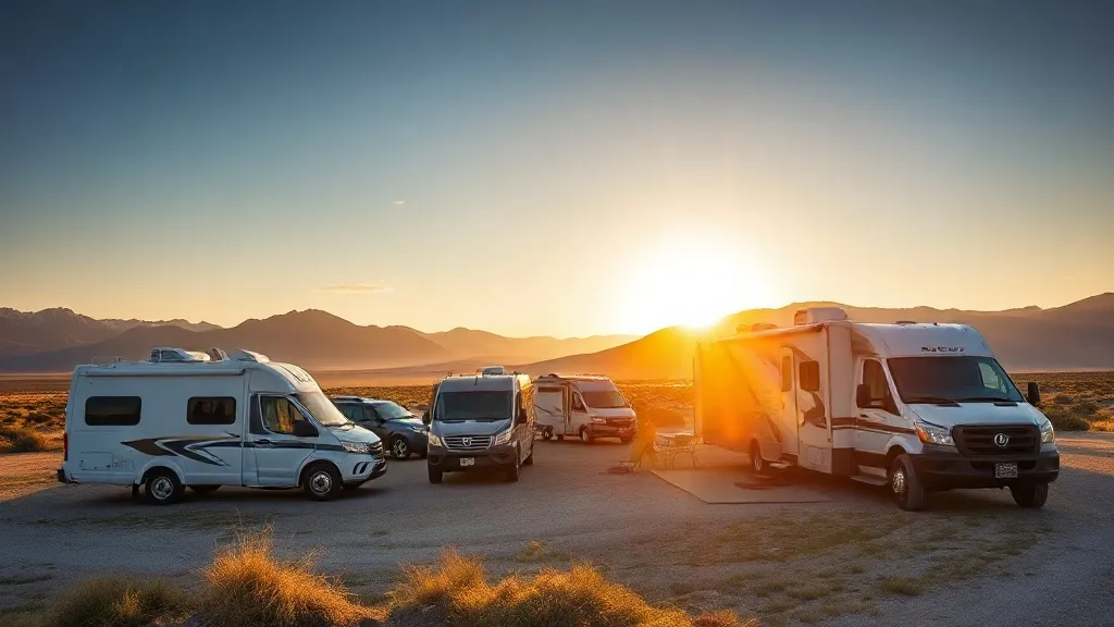
Free RV camping is available on some public land in Montana, but “public” does not automatically mean “camp anywhere.” A legal site needs public access, a road open to your vehicle, no closure or local prohibition, and compliance with the managing unit’s current orders.
The two rules most Montana boondockers need to know are:
- National Forest System land in Montana’s Northern Region generally limits camping to 16 consecutive days and 32 cumulative days per calendar year.
- BLM Montana–Dakotas publishes a 16-day maximum stay and says there are no designated long-term camping areas in Montana, North Dakota, or South Dakota.
A local forest, district, conservation area, fire order, or developed recreation site can be more restrictive. Verify the exact location before leveling the RV.
This guide explains the official tools and planning process. If dry camping is new to you, first read our RV boondocking guide for beginners. For reserved sites and hookups, compare the best RV parks in Montana.
What counts as legal dispersed camping?
Dispersed camping takes place outside a developed campground, usually without a marked pad, water, toilets, trash service, or hookups. It may be free, but it still sits within a managed landscape.
Before staying, answer five questions:
- Who manages the land? Forest Service, BLM, state, tribal, and private parcels can meet along the same road.
- Do you have legal public access? A public parcel reached only by a private road is not an invitation to cross private property.
- Is the road open to your vehicle? On National Forest land, the current Motor Vehicle Use Map is the controlling motorized-use reference.
- Is camping allowed here today? Temporary closures, fire restrictions, food-storage orders, and high-use corridor rules can change the answer.
- Is the existing site suitable for your rig? A legal road can still be too steep, soft, narrow, or low-clearance for an RV.
Do not create a new pad, cut vegetation, widen a turn, or drive around a closure. Use an existing durable site where camping is permitted.
Montana’s 16-day rules
Older guides often repeat a universal 14-day federal limit. That is not the correct blanket rule for the Montana units covered here.
National Forest land
The Forest Service’s Custer Gallatin camping guidance states the Northern Region rule: camping on National Forest System land in Montana for more than 16 consecutive days is prohibited, as is camping for more than 32 cumulative days in a calendar year.
Treat those numbers as an outer boundary, not a promise that every pullout allows a 16-night stay. A local order can prohibit camping entirely or impose a shorter period.
BLM land
BLM Montana–Dakotas publishes a maximum stay of 16 days. It also says the three-state region has no designated long-term camping areas. That is a useful example of why the generalized rule in our national BLM camping guide never overrides a regional order. Do not plan a seasonal residence by shuffling between nearby BLM pullouts.
The BLM manages more than eight million acres across Montana and the Dakotas combined. That regional figure should not be described as eight million Montana-only acres.
Water setbacks and move distances
There is no safe universal “200 feet from every water source” rule or one move distance that applies to every Montana unit. Setbacks, roadside camping corridors, sanitation requirements, and required relocation distances can be defined by the local order or map.
Use an existing site, protect riparian vegetation, and read the current order for the managing unit. If the map or order is unclear, ask the ranger office rather than transferring a rule from another forest or state.
The official maps to download
Crowdsourced camping apps can help identify possibilities, but they do not establish legal access or current motorized use.
Motor Vehicle Use Maps
Every National Forest publishes Motor Vehicle Use Maps, commonly called MVUMs. These maps identify roads and trails open to motor vehicles and may show designated dispersed-camping corridors. They are legal documents, not scenic road maps.
Download the current PDF before losing service. A georeferenced copy in a compatible offline map app can show your location on the map, but it remains your responsibility to interpret the legend and seasonal dates.
An MVUM does not tell you that a road is easy for a trailer. It can mark a road as legally open even when washouts, mud, snow, tight switchbacks, or overhanging branches make it impractical.
BLM land-status maps
Use the BLM’s official Montana–Dakotas georeferenced maps to distinguish BLM parcels and recreation areas. Check public access carefully in checkerboard landscapes. A colored federal parcel does not legalize a route across a ranch, railroad holding, or tribal land.
Current orders
After finding a possible area, check the managing forest or BLM field office for:
- fire restrictions and campfire bans;
- food-storage requirements;
- seasonal road closures;
- temporary hazard or resource closures;
- local stay, waste, and vehicle-distance rules.
Save the relevant pages and phone numbers offline.
Three practical Montana planning regions
The regions below are starting points for official map research, not guaranteed campsite coordinates. Conditions and legal availability change too quickly for a responsible guide to send an unfamiliar RV down a named spur road.
Flathead National Forest: Glacier gateway
Flathead National Forest surrounds much of the country south and west of Glacier National Park. The current MVUM covers motorized access in areas such as Glacier View and Hungry Horse.
This region works for self-contained travelers who want a public-land base outside the national park, but it requires careful map reading. National park rules do not extend free dispersed camping into Glacier, and proximity to a park entrance does not prove that an adjacent pullout is legal.
Expect limited or no service, wildlife requirements, and roads that can deteriorate after rain. Scout with the tow vehicle when possible. For a reservable dry-camping alternative, compare our Fish Creek Campground review.
Custer Gallatin National Forest: Greater Yellowstone
Custer Gallatin covers more than three million acres around parts of the Greater Yellowstone ecosystem. Demand is high around Bozeman, Big Sky, Gardiner, and West Yellowstone, so closures and designated-use rules matter.
Check the forest’s current food-storage order before arrival. Bear-resistant storage applies to more than a cooler: food, trash, pet food, and scented items all require proper control under the applicable order.
Do not assume a listing “near Yellowstone” is close to the entrance you intend to use. Travel around the park is slow and entrance geography matters. If reliable hookups are the priority, use our West Yellowstone RV parks guide instead.
Upper Missouri River Breaks: BLM country
The Upper Missouri River Breaks National Monument allows developed or dispersed camping on public land along the river corridor under its current plan. BLM asks visitors to concentrate use at existing sites and pack out waste.
This is remote country where access, weather, surface conditions, water, and emergency planning matter more than amenities. Some developed BLM campgrounds are paid. For example, James Kipp’s current listing charges $20; it should not be marketed as a free boondocking site.
The Rock Creek and Yellowstone name trap
Search results sometimes combine Rock Creek Road, Montana, and Yellowstone East Entrance as though they identify one camping area. They do not.
The Montana Rock Creek commonly referenced in forest recreation material is east of Missoula. Yellowstone’s East Entrance is in Wyoming beside Shoshone National Forest. A dispersed-camping result for one location is not evidence for the other.
Confirm the state, forest, ranger district, road number, and official map before routing an RV. If the intended destination is the East Entrance, use Shoshone National Forest’s current Wyoming guidance rather than a Montana boondocking list.
RV suitability: legal does not mean reachable
The safest workflow for an unfamiliar dispersed site is to stop before the road becomes difficult and scout without the RV.
Check:
- turnaround space before committing to a narrow road;
- overhead branches and bridge clearances;
- road width for slide-outs and passing traffic;
- slope, soft shoulders, washouts, and mud;
- cellular coverage or a satellite communication backup;
- distance to fuel, water, dump stations, and emergency services.
Avoid arriving after dark. A pin can identify an open patch without revealing the ditch, grade, private gate, or occupied site immediately before it.
Water, waste, fire, and bears
Boondocking has no utility safety net. Arrive with enough potable water and tank capacity to leave without dumping anything on the ground. Pack out all trash, including food scraps and used hygiene products.
Montana fire restrictions can change during a trip. A stone ring does not prove that a fire is currently allowed. Check the official restriction, use only legal fuel and equipment, and extinguish every permitted fire completely.
In bear country, follow the current unit’s food-storage order. Keep food and scented items secured whenever they are not under immediate control. Never store attractants in a tent, and never leave trash outside overnight.
A repeatable trip-planning checklist
- Pick a broad region, not a single crowdsourced pin.
- Identify the managing agency and field office.
- Download the current MVUM or BLM land-status map.
- Verify legal public access and seasonal road dates.
- Read current camping, fire, food-storage, and closure orders.
- Select two or three backup areas plus a developed campground.
- Scout the final road and turnaround without the trailer when possible.
- Camp on an existing durable site and leave it cleaner than you found it.
Frequently asked questions
Is boondocking legal in Montana?
Yes, in many locations where the managing agency permits dispersed camping and you have legal access. It is not legal on every public parcel, road, pullout, wildlife area, or state trust parcel.
How long can you camp on public land in Montana?
The published Northern Region Forest Service rule is 16 consecutive days and 32 cumulative days per calendar year. BLM Montana–Dakotas publishes a 16-day maximum. Local orders can be stricter.
Can I boondock inside Glacier or Yellowstone National Park?
No. National parks require camping in authorized campgrounds or under a specific backcountry permit. Public-land dispersed camping outside a boundary is governed by the adjacent agency, not the national park.
Is a camping app enough to prove a site is legal?
No. Use the current Forest Service MVUM or BLM land-status map, verify public access, and check current orders. Crowdsourced pins can be outdated, misplaced, closed, or located across private access.
Do Montana boondocking sites have toilets or water?
Ordinary dispersed sites have no services. Bring potable water, waste capacity, navigation, communications, and a backup campground plan.
Official planning sources
Start with BLM Montana–Dakotas recreation guidance, the BLM georeferenced map library, and the Custer Gallatin camping page. For any actual stay, the managing unit’s newest map and orders supersede this guide.
About the author
Marisol ReyesCamping & Outdoors Editor
Marisol spent six years as an interpretive ranger in the California and Colorado state park systems before turning to writing full-time. She knows public-land camping from the inside — how reservation windows really work, why some loops fill before others, and which 'first-come, first-served' sites are worth gambling on.
More from Marisol →Keep reading
Yellowstone Campground Reservations: 2026–2027 Booking Guide
Book Yellowstone campgrounds on the correct system: Lodges vs Recreation.gov in 2026, the 2027 switch, exact opening windows, dates and RV limits.
RV Camping in Bear Country: Montana Safety Guide
How to camp safely with bears in Montana — food storage rules for RVs, bear spray basics, and what Glacier and Yellowstone actually require.
Planning a Montana RV Trip: Season, Routes & What to Know
How to plan a Montana RV road trip — the best route from Glacier to Yellowstone, when to go, rig size warnings, and reservation strategies that actually work.