Blue Ridge Parkway Camping: The RV Guide to America's Favorite Drive
Every campground along the Blue Ridge Parkway that fits an RV — from milepost 0 to 469, with elevation warnings, tunnel clearances, and the overlooks worth stopping for.

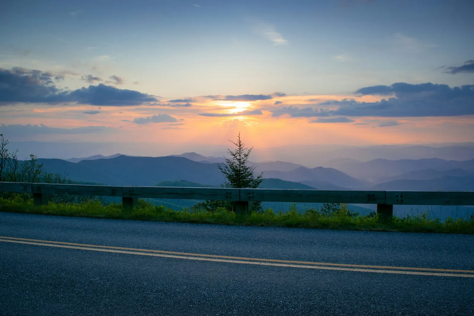
There’s no highway in America quite like the Blue Ridge Parkway. Four hundred sixty-nine miles of two-lane road stitching together the spine of the southern Appalachians, from Shenandoah National Park in Virginia down to the Smokies in North Carolina. No stoplights. No billboards. No commercial traffic. Just ridge after ridge fading into blue haze, with an overlook every few miles reminding you why you bought the rig in the first place.
Most Parkway visitors are day-trippers in passenger vehicles, but NPS currently lists eight developed campgrounds along the route. The sites are rustic, the 2026 base fee is $30 at the campgrounds covered below, and exact RV fit varies by campsite.
But this isn’t a drive you can rush, and it’s not a drive every rig can handle. The Parkway was designed in the 1930s for leisurely motoring, not for 40-foot motorhomes. Understanding what you’re getting into — the tunnels, the grades, the curves, the complete absence of fuel stations — is the difference between a trip you’ll talk about for years and one you’d rather forget.
For more North Carolina RV destinations, see our North Carolina RV parks guide and state hub.
The RV Reality on the Parkway
Let’s get the hard truth out of the way first: the Blue Ridge Parkway was not built for large RVs. It tolerates them, within limits, but it was designed for a 1930s idea of a pleasure drive — narrow lanes, tight curves, and tunnels blasted through solid granite with clearances that predate modern recreational vehicles.
The tunnel problem. There are 26 tunnels on the Parkway, all in North Carolina. The lowest posted clearance is just over 10 feet at Rough Ridge Tunnel (MP 349) and Pine Mountain Tunnel (MP 399). Most Class A motorhomes are 12–13 feet tall. Most fifth wheels are 12.5–13.5 feet. Do the math. The NPS posts clearance heights at each tunnel entrance, but if you’re driving a rig over 10 feet, you need to know which tunnels are on your route before you commit. There are no turnaround options in front of a tunnel — the road behind you will be stacking up with traffic.
The Virginia section has zero tunnels. If your rig is borderline on height, the 217-mile Virginia section from milepost 0 to the North Carolina border is your safe playground. Every campground in the northern section is tunnel-free.
Speed and road character. The posted limit is 45 mph, and you’ll rarely hit it. Curves are constant. Grades reach 6–7% in places. Shoulders are minimal or nonexistent. Passing opportunities are rare. If someone behind you is impatient, use the overlook pulloffs to let them by — there’s one roughly every mile.
No commercial services on the Parkway. No gas stations, no truck stops, no convenience stores. Fuel up before you get on. The Parkway intersects plenty of state highways where you can exit for fuel and supplies, but plan ahead — running out of diesel on a mountain ridge with no cell service is not a story anyone wants to tell.
Which rigs work best? Class B and C motorhomes, truck campers, and travel trailers under 30 feet have the best experience. You’ll fit in every campsite, clear every tunnel, and actually enjoy the curves. Class A rigs and fifth wheels over 30 feet can still drive the Virginia section comfortably and select sections of North Carolina, but you’ll need to plan your route around tunnel clearances and verify campsite lengths at each stop.
Northern Section: Virginia (MP 0–217)
The Virginia stretch of the Parkway runs from Rockfish Gap near Waynesboro down to the North Carolina border. The terrain is gentler here — rolling Appalachian ridges rather than the dramatic peaks of the southern section. Elevations range from about 600 feet to 3,500 feet. No tunnels, wider curves, and generally easier driving for larger rigs.
This is also where the Parkway feels most pastoral. The overlooks frame the Shenandoah Valley to the west and the Piedmont to the east. You’ll pass through sections bordered by split-rail fences and old homestead sites. It’s beautiful in a quiet, agricultural way that’s different from the alpine drama further south.
Otter Creek Campground (MP 60.8)Park details →
Otter Creek is the lowest-elevation campground on the Parkway and one of the most accessible. It sits at just 800 feet, tucked into a valley along Otter Creek — a clear, rocky stream that’s genuinely pleasant to sit beside. The James River is a short walk away, and the Otter Creek Trail follows the water for about 3.5 miles down to the James River Visitor Center.
This is a good first-night stop if you’re entering the Parkway from I-81 near Lexington or from Charlottesville via the Blue Ridge. The campground is shaded, relatively flat, and the creek provides that white-noise backdrop that makes campground generators less noticeable.
- Sites: 42 tent sites, 27 RV sites (no hookups)
- Max RV length: 30 ft (a few sites accommodate up to 35 ft — check the campground map)
- Cost: $30/night
- Elevation: 800 ft
- Dump station: Yes
- Showers: No
- Season: Mid-May through late October
- Reservations: recreation.gov (reserve early for October)
- Nearest fuel: US-501 at Glasgow, about 15 minutes off the Parkway
- Highlight: The Otter Creek Trail is flat, easy, and follows the water — perfect for an evening walk after setting up camp
Peaks of Otter Campground (MP 86)Park details →
Peaks of Otter is the strongest developed camping base in the Virginia section. It sits near 24-acre Abbott Lake, the lodge area and trails including Sharp Top, Harkening Hill and Johnson Farm.
NPS lists 139 total sites: 51 RV and 88 tent. There are no hookups or showers, but the campground has flush toilets, potable water and a dump station. Recreation.gov currently describes 60 reservable sites and 79 first-come sites.
RV limits are site-specific. Official examples include a 23-foot site at A01 and a 28-foot site at T26, so do not treat an old campground-wide 35-foot figure as permission for a large rig.
- Cost: $30/night
- Season: May 22–Oct. 25, 2026
- Reservations: Up to six months; first-come inventory also listed
- Connectivity: NPS lists no campground cell or internet
- Nearest fuel: Bedford via VA-43
See the complete Peaks of Otter Campground review for site-fit examples and booking strategy.
Roanoke Mountain Campground (MP 120.4)Park details →
The smallest campground on the entire Parkway, and the most unusual. Roanoke Mountain is a one-way loop road that spirals up Roanoke Mountain to an overlook, with campsites tucked along the climb. It’s essentially a mountaintop campground with an urban backdrop — the city of Roanoke spreads out in the valley below, and the night views of city lights from 2,000 feet are unexpectedly beautiful.
The campground is basic even by Parkway standards. Sites are small, heavily wooded, and some are genuinely tight for anything over a pop-up camper. This is more of a tent and van campground than a place for a travel trailer. But its proximity to Roanoke — 10 minutes to full grocery stores, restaurants, and fuel — makes it practical as a base camp.
- Sites: 74 tent sites, 30 RV sites (no hookups)
- Max RV length: 25 ft (tight turns on the loop road limit larger rigs)
- Cost: $30/night
- Elevation: 2,000 ft
- Dump station: No (nearest NPS dump station is at Peaks of Otter)
- Season: May through October
- Reservations: recreation.gov — usually available even on short notice
- Nearest fuel: Roanoke, 10 minutes off the Parkway via Mill Mountain Spur Road
- Best for: Small rigs, van campers, and anyone who wants Parkway camping with city convenience nearby
Central Section: NC Border to Blowing Rock (MP 217–320)
The Parkway crosses into North Carolina around milepost 217 and the character changes immediately. Elevations climb. The mountains get steeper. The tunnels begin. This section includes some of the most popular campgrounds on the entire Parkway, and for good reason — the landscape here is the Blue Ridge at its most iconic.
This is also where you need to start paying attention to rig height if you haven’t already. The tunnels begin at milepost 233 and continue south. Check your rig’s actual height — not the manufacturer’s spec, but the height with AC units, antennas, and any rooftop accessories.
Julian Price Memorial Park Campground (MP 297)Park details →
Julian Price is the Parkway’s largest campground, near Price Lake and the Boone/Blowing Rock service corridor. NPS lists 190 total sites: 73 RV, 90 tent and 27 other.
For 2026, Recreation.gov states that all sites are reservation-only and the shower house is closed. There are no individual hookups; potable water and the dump station remain available. NPS lists no reliable campground cell or internet.
RV fit is exact-site rather than a blanket 35-foot maximum. The same is true of the approach: active Parkway work near the Julian Price/Cone Manor corridor makes the live road-status map essential.
- Cost: $30/night
- Season: May 22–Oct. 25, 2026
- Reservations: Required for every site in 2026
- Showers: Closed for 2026
- Nearest services: Blowing Rock and Boone
See the complete Julian Price Campground review for current booking rules, generator loops and roadwork planning.
Linville Falls Campground (MP 316.3)Park details →
Linville Falls is two things: a campground and a waterfall, and both are worth the stop. The falls themselves are a short hike from the campground — the Erwin’s View Trail is about 1.5 miles round trip and delivers multiple overlooks of the most photographed waterfall in North Carolina. The upper falls are a broad cascade; the lower falls drop into Linville Gorge, sometimes called the “Grand Canyon of the East.”
The campground is set back from the falls in a hardwood forest. It’s quieter than Julian Price and generally easier to book. Sites are mostly back-in, with good shade and reasonable spacing. The campground feels more intimate than the larger parks.
Linville Gorge Wilderness is accessible from nearby trailheads if you’re a serious hiker. The gorge walls drop 2,000 feet and the trails are steep and rugged — this is not a casual afternoon walk, but it’s some of the best backcountry in the southeast.
- Sites: 30 tent sites, 40 RV sites (no hookups)
- Max RV length: 30 ft
- Cost: $30/night
- Elevation: 3,250 ft
- Dump station: Yes
- Showers: No
- Season: May through late October
- Reservations: recreation.gov — easier to book than Julian Price, but October weekends still sell out
- Nearest fuel: US-221 at Linville Falls community, about 5 minutes off the Parkway
- Highlight: Hike to Erwin’s View at sunrise before the parking lot fills up. By 10 AM on a fall weekend, you’ll be competing with tour buses.
Southern Section: Crabtree to Mt Pisgah (MP 320–469)
The southern section is the most dramatic stretch of the Parkway and the most challenging for RVs. Elevations push above 6,000 feet. The tunnels are more frequent. Weather can shift from clear skies to dense fog in minutes. This is also the section closest to Asheville, which means weekend traffic from one of the South’s most popular tourist towns.
If you’re running a large rig, seriously evaluate whether you want to drive this section on the Parkway itself or use I-40 and US-74 to reach the campgrounds from lower-elevation access roads. Several campgrounds in this section have alternate access routes that bypass the most tunnel-heavy stretches.
Crabtree Falls Campground (MP 339.5)Park details →
Crabtree Falls is a mid-size campground with a standout hiking trail. The Crabtree Falls Loop Trail is a moderate 2.5-mile circuit that drops into a cove forest and arrives at a 70-foot waterfall — one of the best waterfall hikes on the entire Parkway. The trail is well-maintained but has some steep sections and can be slippery when wet.
The campground sits at 3,600 feet in a dense forest of hardwoods and rhododendrons. In mid-June, the rhododendrons bloom and the forest turns into a tunnel of pink and white. Fall color peaks here in mid-October, about a week later than the higher-elevation parks.
Sites are mostly back-in and somewhat tight. The campground loop has a few spots that require careful maneuvering in anything over 25 feet. It’s doable in a 30-foot rig, but don’t expect wide-open pull-throughs.
- Sites: 22 tent sites, 49 RV sites (no hookups)
- Max RV length: 30 ft (tight in places — check individual site details on recreation.gov)
- Cost: $30/night
- Elevation: 3,600 ft
- Dump station: Yes
- Showers: No
- Season: Mid-May through late October
- Reservations: recreation.gov
- Nearest fuel: Spruce Pine, about 20 minutes east via NC-226
- Tunnel warning: Multiple tunnels between MP 330 and MP 345. Confirm your rig height.
- Highlight: The Crabtree Falls trail is best on a weekday morning. Weekends in October feel like a highway exit.
Mount Pisgah Campground (MP 408.6)Park details →
Mount Pisgah is the Parkway’s highest developed campground at 4,980 feet. NPS lists 125 total sites: 50 RV, 64 tent and 11 other. The campground has no hookups, but it does have seasonal hot showers in Loops B and C, flush toilets, potable water, a dump station and a nearby country store.
Rig fit varies widely. Official sites include RV limits of 35, 50 and 60 feet, disproving the old universal 30-foot figure. The route can be more restrictive than the campsite: the Asheville approach includes nine tunnels, while US 276 from Waynesville reaches the campground from the south with less Parkway tunnel exposure. Every driver still needs live road and clearance checks.
- Cost: $30/night
- Season: May 22–Oct. 25, 2026
- Reservations: Mix of reservable and first-come sites
- Generator policy: Prohibited at all times in Loops C and D; posted hours elsewhere
- Connectivity: NPS lists none; Recreation.gov describes minimal reception
See the complete Mount Pisgah Campground review for route options, exact-site examples and shower details.
Private Parks Near the Parkway
NPS campgrounds have the locations, but they don’t have hookups. If you need full hookups, laundry, hot showers, and reliable Wi-Fi, you’ll need to leave the Parkway for private campgrounds. The good news: the Asheville and Blue Ridge region has a deep bench of private parks, and several are close enough to the Parkway to serve as base camps.
Asheville Area
Asheville Bear Creek RV Park — About 10 miles south of the Parkway’s Asheville access points. Full hookups, pull-through sites for rigs up to 65 feet, pool, laundry, and solid Wi-Fi. It’s a well-run park that serves as a base camp for both the Parkway and downtown Asheville. Sites run $55–75/night depending on season.
Campfire Lodgings — A smaller, more upscale option tucked into the mountains north of Asheville, close to the Parkway around milepost 375. Sites are terraced into a wooded hillside with mountain views. Full hookups on most sites, but the narrow mountain roads to the park aren’t ideal for rigs over 35 feet. $60–90/night.
Asheville East KOA — East of the city toward Black Mountain. Standard KOA amenities — pool, store, playground, cable TV hookups. Clean and predictable. Pull-throughs up to 75 feet. $55–85/night. Good fallback when you want full services without surprises.
Fancy Gap, Virginia
If you’re entering or exiting the Parkway near the NC/VA border, Fancy Gap KOA (near MP 199) and Blue Ridge Campground and RV Park offer full-hookup sites with easy Parkway access. Fancy Gap sits right at the junction of I-77 and the Parkway, making it a natural first or last night stop. Sites run $45–65/night. Both parks accommodate big rigs and have dump stations, laundry, and stores.
These private parks also solve the fuel problem — top off your tank before heading onto the Parkway, or refuel after a day of driving the ridge.
Campground Comparison
| Campground | Milepost | Elevation | RV Sites | Max Length | Hookups | Dump Station | Cost/Night |
|---|---|---|---|---|---|---|---|
| Otter Creek | 60.8 | 800 ft | 27 | 30 ft | No | Yes | $30 |
| Peaks of Otter | 85.9 | 2,500 ft | 51 | Exact site | No | Yes | $30 |
| Roanoke Mountain | 120.4 | 2,000 ft | 30 | 25 ft | No | No | $30 |
| Julian Price | 297 | 3,400 ft | 73 | Exact site | No | Yes | $30 |
| Linville Falls | 316.3 | 3,250 ft | 40 | 30 ft | No | Yes | $30 |
| Crabtree Falls | 339.5 | 3,600 ft | 49 | 30 ft | No | Yes | $30 |
| Mount Pisgah | 408.8 | 4,980 ft | 50 | Exact site; examples to 60 ft | No | Yes | $30 |
Note: All NPS campgrounds on the Parkway operate without individual hookups. Generator rules vary by campground and loop—Julian Price C Loop and Mount Pisgah C/D Loops prohibit them at all times—so verify the selected site before relying on one. Shared water and dump facilities do not replace individual connections.
Planning Your Blue Ridge Parkway RV Trip
When to Go
Fall color season (early to mid-October) is the marquee event. The entire Parkway becomes a 469-mile corridor of red, orange, and gold, and every overlook is a postcard. It’s also the busiest time of year. Campgrounds book out months in advance, the road itself fills with slow-moving leaf-peeper traffic, and weekend parking at popular overlooks can be a nightmare.
If you can swing a weekday trip in October, do it. The color is the same, and the crowds thin by half. If you’re limited to weekends, book campgrounds the moment the reservation window opens — six months out on recreation.gov.
Late May through June is the underrated season. Rhododendrons bloom at lower elevations in late May and climb uphill through June. The weather is warm but not hot, crowds are lighter than summer or fall, and campground availability is better. Wildflowers along the road shoulders are at their peak.
Summer (July–August) is comfortable at elevation — highs in the 70s and 80s at most campgrounds, while the valleys below bake in 90-degree heat. Afternoon thunderstorms are common above 4,000 feet. They blow in fast, dump rain for 20 minutes, and leave. Don’t let them scare you, but pull over if visibility drops.
Winter: Most of the Parkway closes in sections during winter due to ice and snow. Gates close individual stretches without notice. NPS campgrounds are closed November through April. Don’t plan a winter Parkway RV trip.
The Milepost System
The entire Parkway is marked by mileposts — small concrete markers on the right shoulder. Milepost 0 is at Rockfish Gap, Virginia (the southern end of Shenandoah National Park). Milepost 469 is at the Great Smoky Mountains entrance in Cherokee, North Carolina. Every campground, overlook, trail, and visitor center is identified by its milepost number. Learn to navigate by milepost rather than GPS — cell coverage is unreliable on the ridge, and GPS sometimes tries to route you off the Parkway onto forest roads.
Elevation and Weather
The Parkway’s elevation ranges from about 600 feet near the James River to over 6,000 feet at Richland Balsam (MP 431, the highest point on the Parkway). That’s a massive range, and it means weather varies dramatically along the route. It can be 85 degrees at Otter Creek and 55 degrees with fog at Mount Pisgah on the same day. Pack layers regardless of season.
At elevations above 4,000 feet, nighttime temperatures can drop into the 40s even in summer. Frost is possible in May and September at the highest campgrounds. Your furnace isn’t optional — it’s a necessity for shoulder season camping at Mount Pisgah or the higher overlooks.
Fuel Strategy
There is no fuel on the Parkway. Period. The NPS prohibits commercial services on the road itself. You’ll need to exit via cross-roads to fuel up in nearby towns. Major fueling opportunities include:
- MP 0: Waynesboro, VA (full services)
- MP 86: Bedford, VA (via VA-43)
- MP 120: Roanoke, VA (10 minutes)
- MP 297: Blowing Rock or Boone, NC (15 minutes)
- MP 316: Linville Falls community (5 minutes via US-221)
- MP 339: Spruce Pine, NC (20 minutes via NC-226)
- MP 408: Waynesville or Brevard, NC (20 minutes via US-276)
- MP 469: Cherokee, NC (at Parkway terminus)
Plan fuel stops before you need them. Running on fumes at 5,000 feet with no cell signal is a problem with no easy solution.
Best Sections for RVs
If you can only drive part of the Parkway, here’s how to prioritize:
For large rigs (35+ feet): The Virginia section avoids the North Carolina tunnel concentration, but campground fit is still site-specific. Peaks of Otter has only 51 RV sites and many short pads, so reserve only a listing that explicitly accepts the measured rig.
For mid-size rigs (25–35 feet): The central North Carolina section can work when both the campsite and route are verified. Julian Price and Linville Falls are useful bases, but “mid-size” alone does not confirm tunnel or parking-pad clearance.
For small rigs (under 25 feet): More campsites become available, but height—not just length—still determines tunnel clearance. Check live road conditions and exact dimensions before driving the southern section.
Frequently Asked Questions
Can I drive a Class A motorhome on the Blue Ridge Parkway? Potentially, but only after checking the motorhome’s measured height and length against the official NPS tunnel-clearance chart, live closures and the selected campsite. Clearance can vary across a tunnel arch, and a route that works for one Class A may not work for another.
Are there hookups at Parkway campgrounds? No. All NPS campgrounds on the Blue Ridge Parkway are dry camping—no electric, water or sewer hookups at individual sites. Shared water and dump stations are available at developed campgrounds. Bring adequate battery/solar capacity; generator availability depends on the campground and loop.
How far in advance should I book campgrounds? For October fall color weekends, book the day the reservation window opens — six months out on recreation.gov. Summer weekends should be booked 2–3 months ahead. Weekdays and shoulder season are significantly easier to secure.
Is the Parkway open year-round? No. The Parkway closes in sections due to winter weather, typically November through March. All NPS campgrounds close for winter. Check the NPS real-time road closure map before any shoulder season trip.
Can I tow a car behind my RV on the Parkway? Yes, and it’s actually a smart strategy. Park your rig at a campground, unhitch the toad, and explore the tunneled sections by car. This lets you camp at Julian Price or Peaks of Otter and day-trip to sections your rig can’t safely drive.
Is there cell service on the Parkway? Treat campground connectivity as unavailable unless the current official listing says otherwise. NPS lists no cell or internet at Peaks of Otter, Julian Price and Mount Pisgah. Download offline maps and reservation details before leaving a serviced town.
About the author
Marisol ReyesCamping & Outdoors Editor
Marisol spent six years as an interpretive ranger in the California and Colorado state park systems before turning to writing full-time. She knows public-land camping from the inside — how reservation windows really work, why some loops fill before others, and which 'first-come, first-served' sites are worth gambling on.
More from Marisol →Campgrounds in this guide
Facts pages for each park — hookups, rig limits, rates and booking, plus every guide that covers it.
Keep reading
Best RV Parks in North Carolina: Mountains to Coast (2026)
An honest guide to North Carolina's best RV parks and campgrounds, with verified rates, hookups, booking rules and mountain-to-coast trip planning.
North Carolina State Parks RV Camping: Hookups & Rates (2026)
A verified guide to RV camping in North Carolina state parks, with statewide rates, hookup levels, booking rules and six practical campground choices.
Outer Banks Camping: RV Parks Along North Carolina's Barrier Islands
Cape Hatteras National Seashore campgrounds, OBX private RV parks, and the practical guide to beach camping on North Carolina's barrier islands — including 4WD beach access and hurricane season reality.